絶景・猪苗代スキー場 2023-24シーズンPV
By: 絶景・猪苗代スキー場 · 12 Dec
No snow on the ground or falling right now. The 2026/27 season is planned to open on 18 Dec (the resort’s announcement; it moves with the snow). Snow depth and the seven-day outlook appear once snow is on the ground or forecast.
A weather-model figure, worked out the same way for every ski area, and lower than what actually falls. Use it to compare ski areas, not against the resort’s own totals. How we measure →
This season so far (1 Nov to 9 Nov): 3 cm. The average for these dates is under 10 cm, so we do not give a percentage yet. The average is over twelve winters on the same weather model. Across Japan →
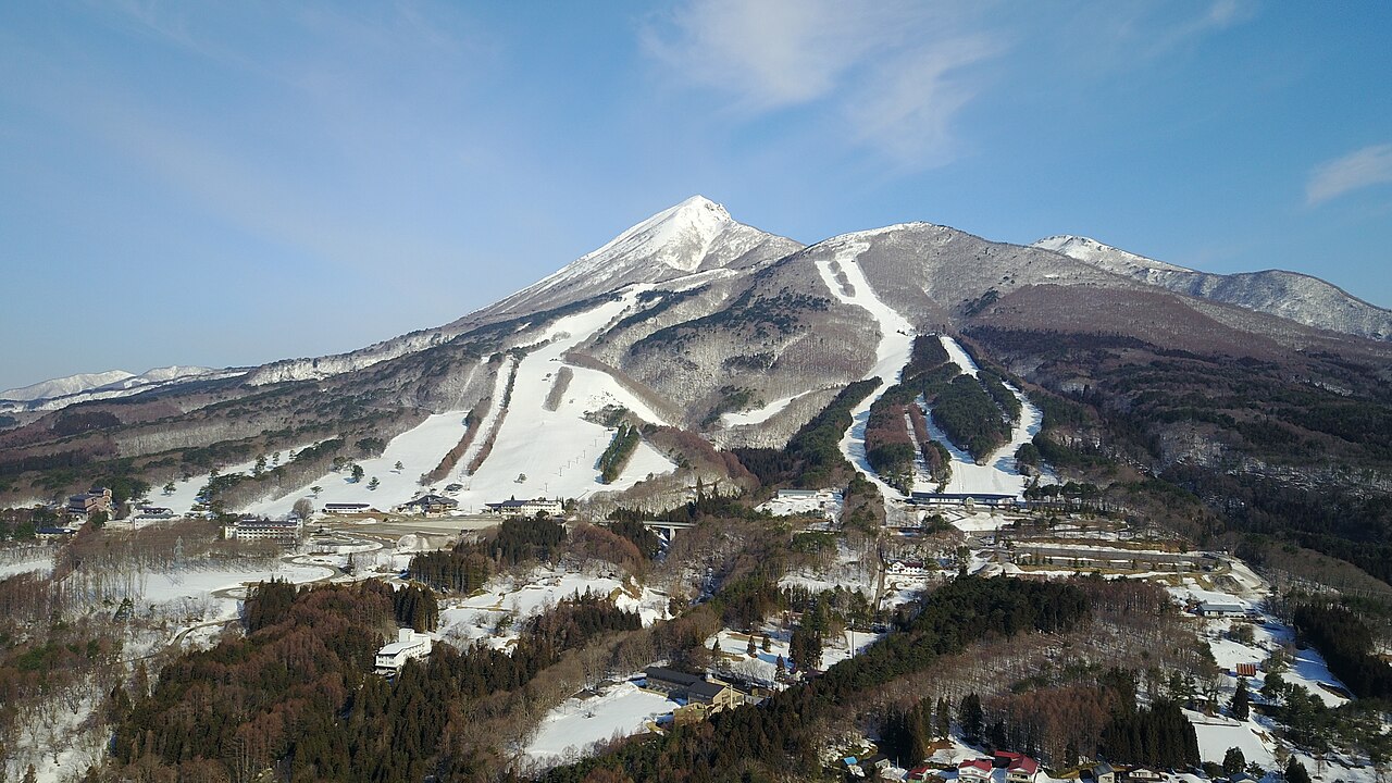
Lake Inawashiro lies below the slopes, and on winter mornings it is sometimes hidden under a sea of cloud. On Unkai Ski days the lifts start at dawn in the Minero Area, so the first runs come with sunrise over the clouds. The same Minero Area has a course used for national competitions. Sources: inawashiro-ski.com, bandaisan.or.jp (sources read 12 Oct 2026; reviewed by the editor)
Modelled from weather data the same way at all 3,069 ski areas we cover. These are not the resort’s own published figures.
The tick marks the median across every Japanese ski area we measure. All four bars run the same way — longer is better.
The quality score leaves out how much snow falls (it uses temperature, frequency, rain and wind).
Within 50 km in a straight line. Ski areas in the same weather-model cell (about 30 km across) get the same figure.
| Ski area | Distance | Seasonal snowfall | World rank |
|---|---|---|---|
| Urabandai Ski Resort | 5.6 km | 347 cm | 289 |
| Listel Ski Fantasia | 6.8 km | 246 cm | 761 |
| Nekoma Mountain | 7.6 km | 347 cm | 289 |
| Numajiri Ski | 14.0 km | 283 cm | 554 |
| Grandeco Snow Resort | 14.0 km | 379 cm | 206 |
Compare side by side with Urabandai Ski Resort and Listel Ski Fantasia →
Counted from the runs and lifts drawn on OpenStreetMap, within the boundary of the ski area. These are not the resort’s own published figures.
Only 16% of the vertical on the runs descends to the north or east. The most common direction is south (82%).
See past trail maps on Skimap.org ↗
Source: OpenSkiMap (© OpenStreetMap contributors, ODbL 1.0). How finely ski areas are drawn varies by region, so treat the counts as indicative. Vertical is the difference between the highest and lowest points of the mapped runs and lifts.
The most snow falls in January. March brings 55% of January’s snowfall.
Across the 12 winters measured, the average is 258 cm, and 6 of them fell short of it. The leanest was 2015/16 with 139 cm; the biggest was 2024/25 with 343 cm (2.5 times as much).
Snowfall each winter (December–March total). The dashed line is the average; the numbers mark the leanest and the biggest winter.
Footage remains the copyright of each operator. JAPANSNOWLINE neither stores nor redistributes it.
Bandai and Inawashiro webcams & snow report — all 7 ski areas →
Videos remain the copyright of whoever filmed them. JAPANSNOWLINE stores no video and plays everything through the standard YouTube player.
More than we show here.
Total snowfall from December to March recorded at the 猪苗代 weather station — 3.7 km from this ski area, 382 m below its mid-slope.
| Three-season average | 316 cm |
| 2023/24 | 188 cm |
| 2024/25 | 503 cm |
| 2025/26 | 258 cm |
The figure calculated on this page is 268 cm.
A weather station is not a ski slope. We picked one at a similar elevation, but it stands in a valley or a village. More snow falls on the mountain above it. We have not tried to guess how much more.
Source: Japan Meteorological Agency historical records
6 hot spring sources with published analyses lie within 5 km of this ski area, nearest first (the hottest is 55.1 °C).
| Source | Distance | Temperature | pH | Type |
|---|---|---|---|---|
| 見祢鉱泉 | 1.6 km | 21.4℃ cold | 7 neutral | simple |
| 表磐梯猪苗代表磐梯猪苗代温泉第2 | 2.1 km | 47.3℃ hot | 6.5 neutral | — |
| 表磐梯ホテルキング | 3.2 km | 46.4℃ hot | 6.5 neutral | — |
| 押立猪苗代リゾートホテル2 | 3.6 km | 46.9℃ hot | 7.4 neutral | simple |
| 翁島鉱泉たなべの湯 | 4.4 km | 20.2℃ cold | 6.8 neutral | simple |
| 磐梯中の湯 | 4.4 km | 55.1℃ hot | 3.6 mildly acidic | simple |
These are analyses of hot spring sources, not a list of baths you can visit. They date from 1910 to 2005, many from decades ago, so today’s temperature and chemistry may differ. Names are as recorded in Japanese. Temperature and pH bands follow Japan’s standard for analysing hot springs.
Source: processed from the hot spring analysis data in the Geothermal Information Database (GRES-DB), Geological Survey of Japan, AIST
Within 20 km in a straight line, nearest first. Some lie over a pass that is closed in winter.
| Place | Type | Distance |
|---|---|---|
| Mount Bandai磐梯山 | Mountain | 2.7 km |
| Lake Hibara桧原湖 | Nature | 10.9 km |
| Lake Inawashiro猪苗代湖 | Nature | 11 km |
| Nisshinkan日新館 | Historic site | 13.1 km |
| Mount Iimori飯盛山 (福島県) | Mountain | 14.7 km |
| Aizuwakamatsu Castle若松城 | Historic site | 17.6 km |
Chosen from the places most read about on Wikipedia, favouring those with an English article. Based on the Japanese Wikipedia lists of sights in each prefecture, as compiled in travel-log-data (CC BY-SA 4.0). English names from Wikidata (CC0). The content of this section is available under CC BY-SA 4.0.
Checked on the official site (19 Oct 2026) · Source. “Not checked” means we have not looked yet. Compare with other ski areas →
Contains advertising. Property names and Rakuten Travel’s booking pages are in Japanese.
30 properties on Rakuten Travel lie within about 3 km of this ski area. The table shows the nearest 12 with a listed price.
| Property (links to Rakuten Travel) | Lowest listed (per person, tax incl.) | Rating | Distance | Getting there |
|---|---|---|---|---|
| 磐梯はやま温泉 猪苗代観光ホテル | ¥6,050 | 3.98/5 505 reviews | 1.0 km | 磐越道猪苗代インターより、猪苗代スキー場を目指して15分。 |
| 磐梯猪苗代はやま温泉 ヴィラ イナワシロ | ¥7,150 | 3.93/5 238 reviews | 1.0 km | JR磐越西線「猪苗代駅」から車で10分(無料送迎有り、要問合せ)/i猪苗代磐梯高原インターから車で15分 |
| スポーツパル | ¥5,500 | 2.50/5 67 reviews | 1.2 km | 磐越西線 猪苗代駅下車 タクシー10分 |
| フォレストリゾート 猪苗代 四季の里 | ¥7,350 | 4.15/5 422 reviews | 1.2 km | 猪苗代駅より車で7分<時間(10時~16時)に応じ電話連絡にて送迎可> |
| レイクビュー猪苗代荘 | ¥3,850 | 4.47/5 46 reviews | 1.3 km | 猪苗代駅よりお車にて約15分 |
| ペンションRB | ¥5,600 | 4.14/5 109 reviews | 1.4 km | 猪苗代駅より車で8分、猪苗代ICより車で11分 |
| ペンション ヴェルレーヌ | ¥7,700 | 4.57/5 53 reviews | 1.7 km | 磐越自動車道猪苗代磐梯高原ICより県道7号線経由で15分。 |
| あるぱいんロッジ | ¥7,100 | 4.67/5 25 reviews | 1.8 km | 磐越西線 猪苗代駅/磐越自動車道 猪苗代磐梯高原IC |
| 民宿 鈴木屋 <福島県耶麻郡> | ¥6,000 | — | 2.0 km | JR磐越西線 猪苗代駅からお車で5分/猪苗代磐梯高原ICからお車で約10分 |
| 御もてなしの宿 悠ゆ亭 | ¥24,200 | 4.50/5 159 reviews | 2.1 km | JR磐越西線 猪苗代駅 タクシーで5分/ 磐越自動車道 猪苗代磐梯高原 ICより6分 |
| 温泉ロッジ・アルピナ | ¥4,000 | 5.00/5 34 reviews | 2.2 km | 猪苗代駅よりお車にて約10分 |
| 静楓亭 | ¥28,500 | 4.83/5 112 reviews | 2.2 km | 猪苗代駅よりお車にて10分、電車でお越しのお客様は猪苗代駅よりタクシーの送迎をご用意しております(要事前連絡) |
Prices are the lowest Rakuten Travel lists; a property name, or “Pick dates and guests” above, shows prices and rooms for your dates.
Contains advertising. Property names and Rakuten Travel’s booking pages are in Japanese. · Property data by Rakuten Travel (Supported by Rakuten Developers)
2 places within 12 km of the slopes, as mapped on OpenStreetMap, many of them small inns and pensions. Many are not on booking sites — open the name for the website or the map.
Nearest: 1.9 km
Accommodation data: OpenStreetMap
Other booking sites: Booking.com ↗ · Agoda ↗ · Rakuten Travelad ↗
“ad” marks links that pay us a commission if you book. Links without it are not affiliated.
Planning a trip · 28 Sep 2026
Japan for Beginners: Half Its Pisted Kilometres Are Graded Easy, Twice the US ShareHalf of Japan's pisted kilometres are graded easy or novice — against 25% in the United States and 28% in Canada. And 255 of Japan's 397 ski areas have a natural hot-spring source within 5 km. Here are the numbers, the caveat about grading, and the resorts where a first-timer gets the most of both.