Not open yet for 2026/27. We have not yet found an official opening date. The snowfall below is a model figure and does not mean the slopes are skiable.
Base depth
0cm
Snow 48h
0cm
Next 72h
0cm
A weather-model figure, worked out the same way for every ski area, and lower than what actually falls. Use it to compare ski areas, not against the resort’s own totals. How we measure →
Snow 24h
0 cm
Next 24h
0 cm
Temperature
−2°C
Max wind
13 km/h
Elevation
1,390–1,546 m
Across
1.7 km
Updated: 10 Nov 2026, 12:15
7-day outlook
Date
Weather
Snow (cm)
Low / high (°C)
Wind (km/h)
Tue 10 Nov
Snow
0
−2 to 1
13
Wed 11 Nov
Cloudy
0
−3 to 3
12
Thu 12 Nov
Clear
0
0 to 10
7
Fri 13 Nov
Cloudy
0
3 to 12
7
Sat 14 Nov
Cloudy
0
4 to 13
6
Sun 15 Nov
Cloudy
0
6 to 14
6
Mon 16 Nov
Drizzle
0
0 to 7
9
Score breakdown
Fresh (48h)0/40
Forecast (24h)0/25
Snow quality4/20
Wind8/10
Base0/5
The five add up to the 100-point Powder Score: more fresh snow, more on the way and colder air all push it up. How we measure
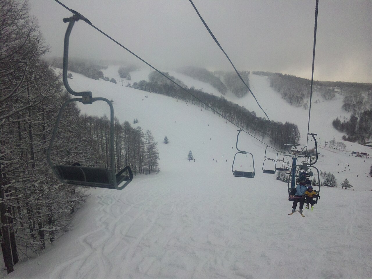
Minenohara Kogen is a highland village lined with pensions. On clear days the top of Course B looks out over the city of Nagano and the Northern Alps. Course F follows a twisting gully, and the way it swings skiers from side to side has earned it the nickname Furiko-sawa, the pendulum valley. Sources: minenoharakogen.com, minenohara-tourism.com, city.suzaka.nagano.jp (sources read 12 Oct 2026; an AI draft the site operator has not yet checked)
Weather models read low in the mountains: a Japan Meteorological Agency station 4 km away measured 379 cm a winter over the last three seasons, against 203 cm from the model.
Runs and lifts
Counted from the runs and lifts drawn on OpenStreetMap, within the boundary of the ski area. These are not the resort’s own published figures.
Marked runs
9
Run length
7.6km
Lifts
3
Vertical
156m
Top 1,546 m · base 1,390 m
Run map
NoviceEasyIntermediateLift
North is up. Runs are coloured by difficulty; black lines are lifts.Slope shape, difficulty and lift types
The shape of the mountain
Longest run on the map2.3 km
Steepest pitch26°measured over at least 30 m
Average gradient of the runs8.6°
Which way the slopes face
North14%
East22%
South16%
West49%
Only 36% of the vertical on the runs descends to the north or east. The most common direction is west (49%).
The most snow falls in January. March brings 80% of January’s snowfall. That is a gentler fall than the median for ski areas in Japan (52%). In amount, March brings 49 cm, about the same as the median of 46 cm.
48cmDec
61cmJan
40cmFeb
49cmMar
Average snowfall by month, last 12 winters
Winter by winter
Across the 12 winters measured, the average is 198 cm, and 6 of them fell short of it. The leanest was 2015/16 with 159 cm; the biggest was 2016/17 with 245 cm (1.5 times as much).
Total snowfall from December to March recorded at the 菅平 weather station — 4 km from this ski area, 168 m below its mid-slope.
Three-season average
379 cm
2023/24
509 cm
2024/25
345 cm
2025/26
284 cm
The figure calculated on this page is 203 cm.
A weather station is not a ski slope. We picked one at a similar elevation, but it stands in a valley or a village. More snow falls on the mountain above it. We have not tried to guess how much more.
Source: Japan Meteorological Agency historical records
Hot springs nearby, as analysed
1 hot spring sources with published analyses lie within 5 km of this ski area, nearest first (the hottest is 34.5 °C).
Show the sources
Source
Distance
Temperature
pH
仙仁仙峡荘右洞
4 km
34.5℃ warm
7.9 mildly alkaline
These are analyses of hot spring sources, not a list of baths you can visit. They date from 1910 to 2005, many from decades ago, so today’s temperature and chemistry may differ. Names are as recorded in Japanese. Temperature and pH bands follow Japan’s standard for analysing hot springs.
Source: processed from the hot spring analysis data in the Geothermal Information Database (GRES-DB), Geological Survey of Japan, AIST
Worth seeing nearby
Within 20 km in a straight line, nearest first. Some lie over a pass that is closed in winter.
Chosen from the places most read about on Wikipedia, favouring those with an English article. Based on the Japanese Wikipedia lists of sights in each prefecture, as compiled in travel-log-data (CC BY-SA 4.0). English names from Wikidata (CC0). The content of this section is available under CC BY-SA 4.0.
Map
The weather map, and where it sits among nearby ski areas.
Pick dates and guests to check rooms on Rakuten Travel
Prices are the lowest Rakuten Travel lists; a property name, or “Pick dates and guests” above, shows prices and rooms for your dates.
Contains advertising. Property names and Rakuten Travel’s booking pages are in Japanese. · Property data by Rakuten Travel (Supported by Rakuten Developers)
Places to stay on the map
3 places within 12 km of the slopes, as mapped on OpenStreetMap, many of them small inns and pensions. Many are not on booking sites — open the name for the website or the map.
Hakuba Happo-One opened early-bird sales at 10:00 on 1 October. A day costs ¥6,400 against ¥9,800 at the window, 35% off. But every ticket on the list except one needs a My Number Card and a Japanese phone app. A visitor from abroad can buy exactly one of them, at 15% off.