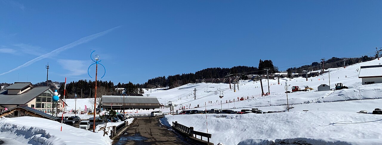
No snow yet. Not open yet for 2026/27. We have not yet found an official opening date. Snow depth and the seven-day outlook appear once snow is on the ground or forecast.
Typical snowfall
553cm
A weather-model figure, worked out the same way for every ski area, and lower than what actually falls. Use it to compare ski areas, not against the resort’s own totals. How we measure →
Elevation
431–721 m
Across
2.6 km
On clear days the runs look out over the Sea of Japan. The tree-run area is left in its natural state; skiers apply in advance and enter through a designated gate, carrying a helmet, a mobile phone and a whistle. Drivers coming from the Kanto region are advised to set their satnav to Mushikawa-Osugi Station on the Hokuhoku Line first, so they are not routed onto a narrow mountain road. Sources: yukidaruma-kogen.com, niigata-kankou.or.jp, city.joetsu.niigata.jp (sources read 12 Oct 2026; an AI draft the site operator has not yet checked)
How much snow it gets
Modelled from weather data the same way at all 3,069 ski areas we cover. These are not the resort’s own published figures.
Seasonal snowfall
553cm
per season
Worst of 12 winters
301cm
The middle winter of the 12: 561 cm. The best: 693 cm.
World rank
61
of 3,069 worldwide
Rank in country
35
of 397 in Japan
Elevation rank
228
Highest to lowest, of 397 in Japan. The centre point sits at 644 m, 122 m below the national median.
Quality rank
175
of 397 in Japan
Temp when snowing
−2.2°C
Japanese median: −3.6°C
Rain days
26%
Japanese median: 16%
Days over 5 cm
33%
Japanese median: 15%
Wind when snowing
16km/h
Average daily peak, 10 m above ground across a model grid cell; not the wind on ridges or lift tops
Dryness30
Frequency93
Freedom from rain35
Calm when snowing (model grid)98
The tick marks the median across every Japanese ski area we measure. All four bars run the same way — longer is better.
The quality score leaves out how much snow falls (it uses temperature, frequency, rain and wind).
Compared with what is nearby
Within 50 km in a straight line. Ski areas in the same weather-model cell (about 30 km across) get the same figure.
Counted from the runs and lifts drawn on OpenStreetMap, within the boundary of the ski area. These are not the resort’s own published figures.
Marked runs
3
Run length
2.9km
Lifts
3
Vertical
290m
Top 721 m · base 431 m
Run map
EasyIntermediateLift
North is up. Runs are coloured by difficulty; black lines are lifts.Lifts that run far beyond the ski area are cut at the edge of the map.Slope shape, difficulty and lift types
The shape of the mountain
Longest run on the map1.8 km
Steepest pitch17°measured over at least 30 m
Average gradient of the runs9.7°
Which way the slopes face
North87%
East0%
South0%
West13%
87% of the vertical on the runs descends to the north or east. Those slopes get the least sun, so the snow lasts longer.
The most snow falls in January. March brings 36% of January’s snowfall. That is a steeper fall than the median for ski areas in Japan (52%): the snow here is concentrated early in the season. For skiing, though, the amount matters more than the share: March brings 70 cm, more than the median of 46 cm.
157cmDec
197cmJan
130cmFeb
70cmMar
Average snowfall by month, last 12 winters
Winter by winter
Across the 12 winters measured, the average is 553 cm, and 5 of them fell short of it. The leanest was 2015/16 with 301 cm; the biggest was 2016/17 with 693 cm (2.3 times as much).
Footage remains the copyright of each operator. JAPANSNOWLINE neither stores nor redistributes it.
Worth seeing nearby
Within 20 km in a straight line, nearest first. Some lie over a pass that is closed in winter.
Show the list
Place
Type
Distance
Matsunoyama Onsen松之山温泉
Hot spring town
10.2 km
Sakae Village History and Culture Museum栄村歴史文化館
Museum
11.3 km
Bijinbayashi美人林
Nature
12.8 km
Ryūgakubo竜ヶ窪
Nature
14.1 km
Nozawa Onsen野沢温泉
Hot spring town
14.2 km
Matsudai Nohbutaiまつだい「農舞台」
Museum
14.6 km
Chosen from the places most read about on Wikipedia, favouring those with an English article. Based on the Japanese Wikipedia lists of sights in each prefecture, as compiled in travel-log-data (CC BY-SA 4.0). English names from Wikidata (CC0). The content of this section is available under CC BY-SA 4.0.
Map
The weather map, and where it sits among nearby ski areas.
about 33 km from Joetsu IC or Kakizaki IC (Hokuriku Expressway); about 60 km from Muikamachi IC (Kan-Etsu Expressway)
Winter roads
Free shuttle between Mushigawa-Osugi Station and the centre house on specified days only; reservation required by 4 pm the day before (tel. 025-593-2041). On other days, take a taxi
Source: yukidaruma-kogen.com · checked 1 Nov 2026. Shuttle days and times change with the season; check the official site before you go.
Pick dates and guests to check rooms on Rakuten Travel
Prices are the lowest Rakuten Travel lists; a property name, or “Pick dates and guests” above, shows prices and rooms for your dates.
Contains advertising. Property names and Rakuten Travel’s booking pages are in Japanese. · Property data by Rakuten Travel (Supported by Rakuten Developers)
Places to stay on the map
1 places within 12 km of the slopes, as mapped on OpenStreetMap, many of them small inns and pensions. Many are not on booking sites — open the name for the website or the map.
Hakuba Happo-One opened early-bird sales at 10:00 on 1 October. A day costs ¥6,400 against ¥9,800 at the window, 35% off. But every ticket on the list except one needs a My Number Card and a Japanese phone app. A visitor from abroad can buy exactly one of them, at 15% off.