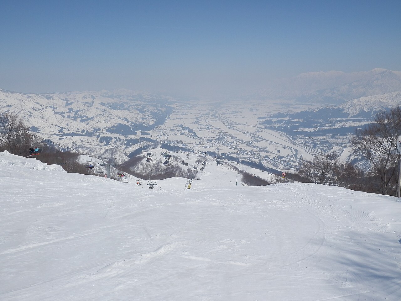
No snow yet. The 2026/27 season is planned to open on 18 Dec (the resort’s announcement; it moves with the snow). Snow depth and the seven-day outlook appear once snow is on the ground or forecast.
Opens
18 Dec
Typical snowfall
695cm
A weather-model figure, worked out the same way for every ski area, and lower than what actually falls. Use it to compare ski areas, not against the resort’s own totals. How we measure →
Elevation
258–916 m
Across
3.0 km
A piste link joins Ishiuchi Maruyama to neighbouring GALA Yuzawa, meeting GALA's northern Roman Holiday area. Just off the top of the Sunrise Express, halfway up the mountain, The Veranda Ishiuchi Maruyama has a viewing terrace facing the Uonuma Plain and the Echigo mountains. Sources: gala.co.jp, yuzawasnowlink.com, ishiuchi.or.jp (sources read 12 Oct 2026; reviewed by the editor)
How much snow it gets
Modelled from weather data the same way at all 3,069 ski areas we cover. These are not the resort’s own published figures.
Seasonal snowfall
695cm
per season
Worst of 12 winters
328cm
The middle winter of the 12: 750 cm. The best: 983 cm.
World rank
12
of 3,069 worldwide
Rank in country
10
of 397 in Japan
Elevation rank
256
Highest to lowest, of 397 in Japan. The centre point sits at 538 m, 228 m below the national median.
Quality rank
180
of 397 in Japan
Temp when snowing
−1.7°C
Japanese median: −3.6°C
Rain days
41%
Japanese median: 16%
Days over 5 cm
36%
Japanese median: 15%
Wind when snowing
13km/h
Average daily peak, 10 m above ground across a model grid cell; not the wind on ridges or lift tops
Dryness26
Frequency100
Freedom from rain35
Calm when snowing (model grid)100
The tick marks the median across every Japanese ski area we measure. All four bars run the same way — longer is better.
The quality score leaves out how much snow falls (it uses temperature, frequency, rain and wind).
Compared with what is nearby
Within 50 km in a straight line. Ski areas in the same weather-model cell (about 30 km across) get the same figure.
The most snow falls in January. March brings 29% of January’s snowfall. That is a steeper fall than the median for ski areas in Japan (52%): the snow here is concentrated early in the season. For skiing, though, the amount matters more than the share: March brings 76 cm, more than the median of 46 cm.
184cmDec
260cmJan
177cmFeb
76cmMar
Average snowfall by month, last 12 winters
Winter by winter
Across the 12 winters measured, the average is 695 cm, and 5 of them fell short of it. The leanest was 2015/16 with 328 cm; the biggest was 2021/22 with 983 cm (3.0 times as much).
Total snowfall from December to March recorded at the 湯沢 weather station — 3.6 km from this ski area, 243 m below its mid-slope.
Three-season average
810 cm
2023/24
619 cm
2024/25
1080 cm
2025/26
732 cm
The figure calculated on this page is 686 cm.
A weather station is not a ski slope. We picked one at a similar elevation, but it stands in a valley or a village. More snow falls on the mountain above it. We have not tried to guess how much more.
Source: Japan Meteorological Agency historical records
Hot springs nearby, as analysed
5 hot spring sources with published analyses lie within 5 km of this ski area, nearest first (the hottest is 61.5 °C).
Show the sources
Source
Distance
Temperature
pH
Type
石打丸山丸山3号
1.5 km
25.8℃ lukewarm
8.1 mildly alkaline
—
上野鉱泉新泉1号
1.8 km
24.3℃ cold
8.1 mildly alkaline
simple
上越後楽園上越後楽園
3.2 km
31.1℃ lukewarm
8.2 mildly alkaline
—
清津峡薬師の湯(小出4号)
3.8 km
48℃ hot
9.2 alkaline
alkaline simple
湯沢第3配湯所 混湯
4 km
61.5℃ hot
8.3 mildly alkaline
simple
These are analyses of hot spring sources, not a list of baths you can visit. They date from 1910 to 2005, many from decades ago, so today’s temperature and chemistry may differ. Names are as recorded in Japanese. Temperature and pH bands follow Japan’s standard for analysing hot springs.
Source: processed from the hot spring analysis data in the Geothermal Information Database (GRES-DB), Geological Survey of Japan, AIST
Worth seeing nearby
Within 20 km in a straight line, nearest first. Some lie over a pass that is closed in winter.
Chosen from the places most read about on Wikipedia, favouring those with an English article. Based on the Japanese Wikipedia lists of sights in each prefecture, as compiled in travel-log-data (CC BY-SA 4.0). English names from Wikidata (CC0). The content of this section is available under CC BY-SA 4.0.
Map
The weather map, and where it sits among nearby ski areas.
Pick dates and guests to check rooms on Rakuten Travel
Prices are the lowest Rakuten Travel lists; a property name, or “Pick dates and guests” above, shows prices and rooms for your dates.
Contains advertising. Property names and Rakuten Travel’s booking pages are in Japanese. · Property data by Rakuten Travel (Supported by Rakuten Developers)
Places to stay on the map
6 places within 12 km of the slopes, as mapped on OpenStreetMap, many of them small inns and pensions. Many are not on booking sites — open the name for the website or the map.
Hakuba Happo-One opened early-bird sales at 10:00 on 1 October. A day costs ¥6,400 against ¥9,800 at the window, 35% off. But every ticket on the list except one needs a My Number Card and a Japanese phone app. A visitor from abroad can buy exactly one of them, at 15% off.